
"Summer afternoon—to me, those have always been the two most beautiful words in the English language."
- Henry James
June Weather Summary
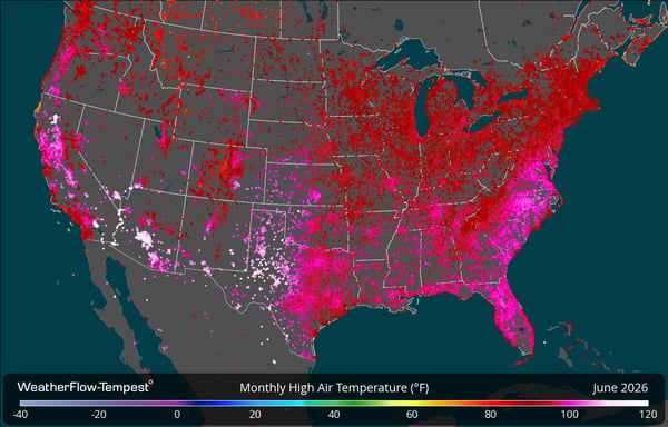
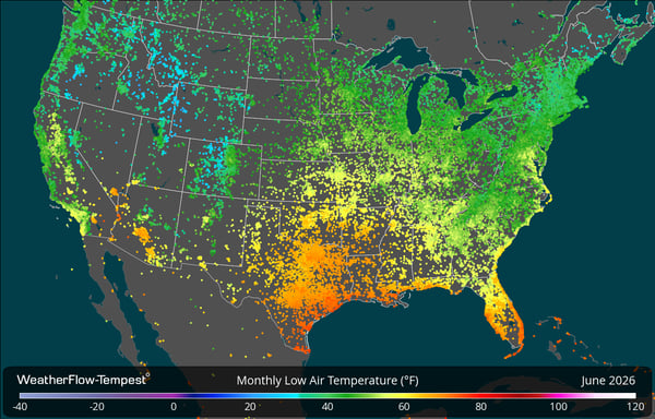
June delivered the transition most of the U.S. expects this time of year: the shift away from unpredictable spring storms and temps to the steadier heat patterns that define our summer. High pressure built across much of the West and South through the month, pushing temperatures up early and holding them there longer than typical for June. Meanwhile, parts of the interior West and higher elevations were reminded that summer doesn't arrive everywhere on the same schedule, with overnight lows still dropping into the 20s and teens in some mountain valleys. That range showed up clearly across the Tempest network.
The month's high came in at 118°F in Needles, CA, a reminder of the Southwest's early and intense heat buildup.
On the other end, Stanley, ID recorded a low of 17°F, a reminder that high-elevation basins in the Rockies can still see overnight freezes well into early summer.
Data Look Back: Smoke Plumes and Solar Radiation
Earlier this month, wildfire smoke from Utah drifted into Colorado, and the Tempest network captured it in a pretty unique way: shortwave radiation data. As the plume moved across central Colorado, incoming solar radiation dropped nearly 50% in the areas it passed over. It's a good reminder of what real-time, local data can tell you about what's happening overhead. Whether you're tracking smoke, keeping an eye on air quality, or just curious what's actually reaching your backyard, that kind of hyperlocal detail is something models alone can't give you.
This Month in Weather History
Thirty-one years ago this month, a major heat wave settled over the Midwest, hitting the city of Chicago especially hard. According to the National Weather Service, the peak came on July 13 and 14, when combined heat and humidity pushed heat index values above 115°F during the day, and the city's urban heat island kept it above 100°F well after sunset. The high dew points, near or above 80°F, were the real driver. NWS Chicago notes the highest air temperature recorded during the event was 106°F at Midway Airport, but it was the humidity layered on top of that heat that made conditions so dangerous.
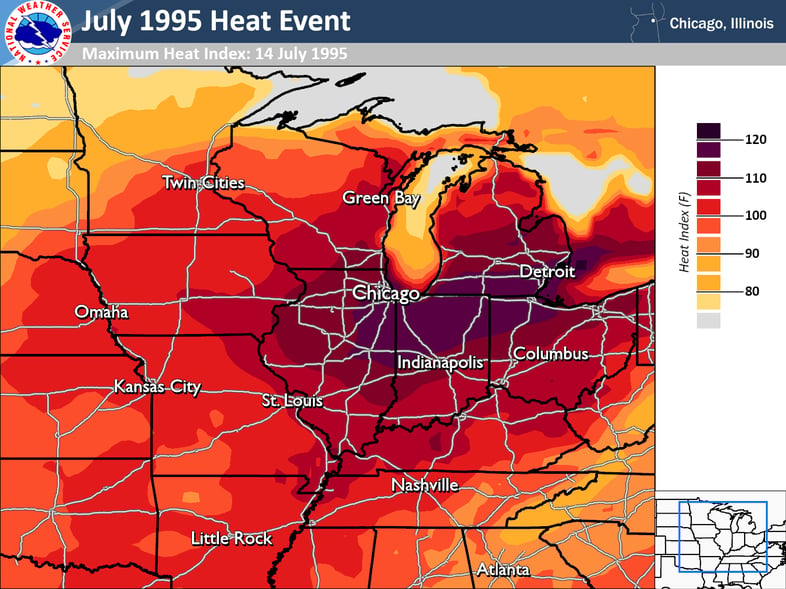
The toll was severe. The heat wave claimed over 500 lives in Chicago alone, with hundreds more across the broader Midwest, making it one of the deadliest weather events in the region's history. In its aftermath, the NWS and the City of Chicago built new heat warning criteria based on impact, not just temperature, a framework that still shapes how Extreme Heat Watches and Warnings are issued today.
Photo and details from the National Weather Service.
Tempest in the Elements
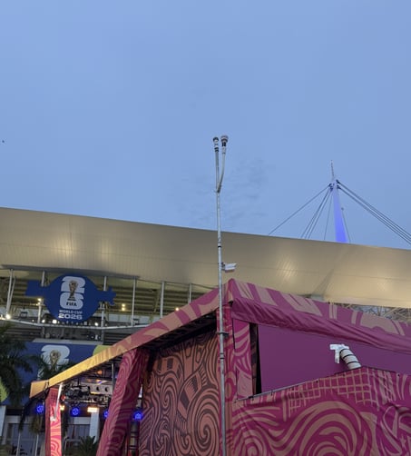
Spotting a TempestOne at a U.S. soccer match is quickly becoming one of our favorite game-day traditions, and we're already two for two. First Miami, then Seattle, two very different climates, same reliable station in the background. Wherever they show up, those stations are doing what they always do: capturing real, hyperlocal weather data, even in the middle of a packed stadium. Want your setup or project to be featured? Send us a photo of your Tempest setup (or include it in your review), your creative weather project, or other unique ways you’re using your station - or use the hashtag #tempestwx.
WRF 26 Deployed Across Tempest Lifestyle Apps
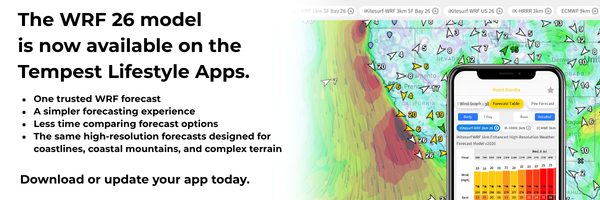
We've rolled out a major forecast upgrade across our lifestyle weather apps: iKitesurf, iWindsurf, SailFlow, FishWeather, and WindAlert. WRF 26 is our high-resolution wind prediction model, and this update brings more reliable model run completion, meaning the forecast you count on shows up when you need it, every time. Download or update your app today to see it in action.
Other Weather News
Rapidly Intensifying El Niño Could Be Historic
NOAA's Climate Prediction Center has issued an El Niño Advisory, confirming El Niño conditions are now present in the tropical Pacific, and forecasters now put the odds at nearly 90% that it peaks as a strong or very strong event this winter. For the Midwest, that could mean a cooler, stormier summer followed by a milder, lower-snow winter, though an active pattern doesn't mean winter gets skipped entirely. Read More >>>
First Named Storm of 2026 Atlantic Hurricane Season
Arthur became the first named storm of the 2026 Atlantic storm season this June, forming slightly ahead of the historical average start date and bringing heavy rain to the northwestern Gulf Coast. While it never strengthened much beyond tropical storm status, forecasters flagged it as a rainfall threat more than a wind threat, with totals reaching into the double digits in some spots and flash flooding stretching hundreds of miles inland as the system moved north. Read More >>>
Can Plants Really Predict the Weather?
From drooping clover to closing pinecones, gardeners have leaned on plant behavior to anticipate weather shifts for generations. It turns out there's some science behind a few of these signs, even if plants can't technically forecast anything. A fun look at garden folklore, and how pairing it with real hyperlocal data can confirm what your yard is already telling you. Read More >>>
Back to: Newsletter, Articles